The National weather service says that
a significant winter storm is expected Friday afternoon into
Saturday evening and will likely include all precipitation types,
strong winds, and blizzard conditions.
Saturday, although it will be cold looks like it, will be the better day of the weekend. The National Weather Service is saying that we could see some more snow Sunday.
Right now the dividing line for the 6-8" or 3-5" runs diagonally through Rice County...
For those that want more time on winter activities, you are happy with the forecast. But spring high school games are going to get backed up and rescheduled with the forecast of more snow and cold temperatures.
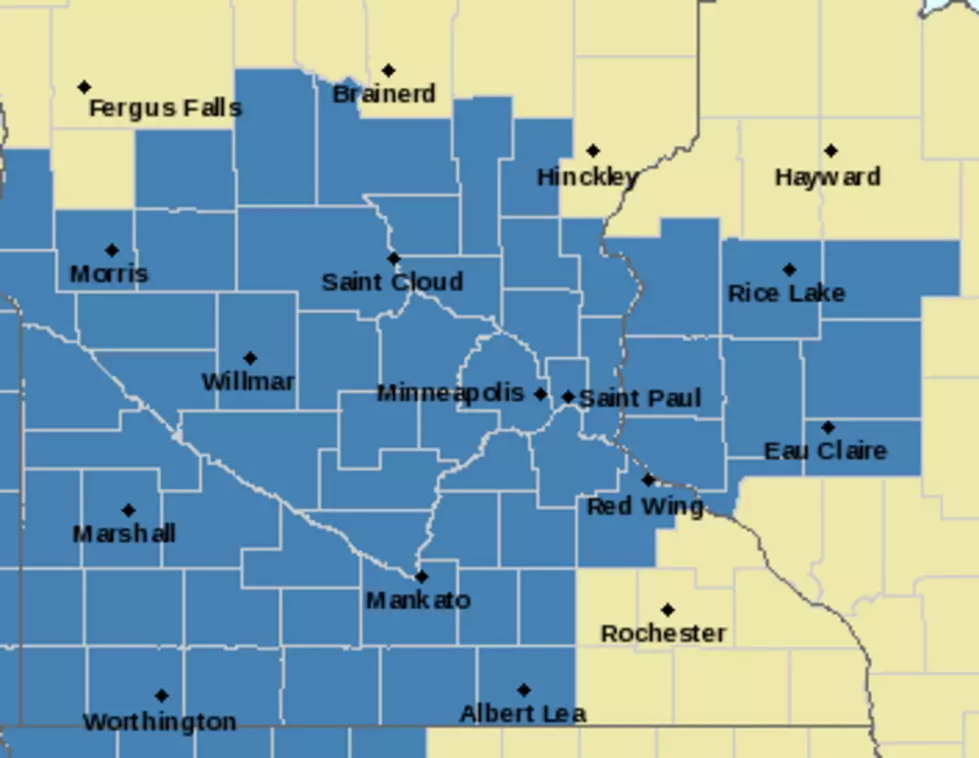
The National Weather Service now says the Winter Storm Warning remains in effect across most of west central and south central Minnesota, with a Winter Weather
Advisory in effect from Alexandria to Waconia and Faribault. This update was to shift snow totals south about a county.
A Winter Storm Watch has been issued for areas south of I-94 in
Minnesota Friday afternoon into Saturday morning. Snow will
develop across the Dakotas and build eastward into west central
Minnesota late Friday morning
A winter storm warning is in effect from northwest Minnesota through southeast Minnesota and west central Wisconsin from Monday morning through Tuesday morning. A winter weather advisory is in effect for surrounding locations where less snow is
expected.
After anywhere from 3-6" around the area Thursday night and this morning, our attention now turns to the next system coming in, expecting to bring us a lot more snow.
A Winter Weather Advisory remains in effect for the entire area tonight. Steady snow will overspread the area by this evening. The snow could be heavy at times before ending late tonight.
In the southeastern part of Minnesota, there are 102 snowplows are on the state highways in the 11-county MnDOT District 6. These plows handle 3,774 lane miles. An average route for drivers is 31 miles.