Weather Service Now Says 16 Tornadoes Hit SE Minnesota Sept. 20
The National Weather Service has updated their severe weather report in regards to the tornadoes that SE Minnesota experienced on September 20. The NWS has now raised the number of tornadoes that touched down in the area from 10 to 16.
The event took place over a week ago, but there were difficulties in surveying damage due to what the NWS said was widespread wind damage that made spotting tornadic damage a longer process than usual. The final report may not be in for more than a month as a result.
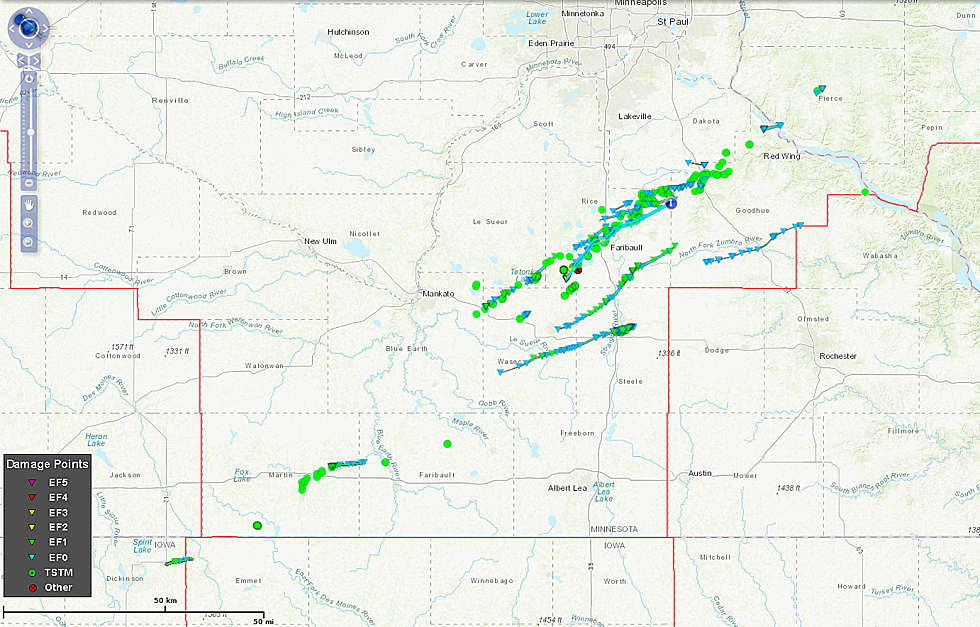
Seven were EF0's, eight were EF1's and one was an EF2 tornado. That EF2 was on the ground for 26 miles with a maximum wind to 130 mph reaching a 1000 yard width striking the towns of Morristown, Warsaw and the western edge of Faribault.
You can see in the image above the paths that the twisters made that stretched into Western Wisconsin. For the tornado that hit near Medford, the NWS has initially reported it to be an EF1 with a max wind of 110 mph and a width of 500 yards. This tornado was on the ground for 28 miles reaching through Waseca, Steele, Rice and extreme western Goodhue Counties.
The tornado that hit in Morristown and Faribault was the strongest of the 16, rated at an EF2 and was on the ground for almost 26 miles with a maximum width of 1000 yards. According to the updated preliminary report:
This tornado destroyed several buildings at the airport. The path beyond
Faribault is more uncertain with widespread wind damage and other
potential tracks complicating the survey.
More From KRFO-AM


![Owatonna’s Football Captains Lead From the Trenches [Audio]](http://townsquare.media/site/687/files/2018/09/20180926_180405_HDR-e1538109477734.jpg?w=980&q=75)


