The Potential For Severe Weather Has Increased For Tonight
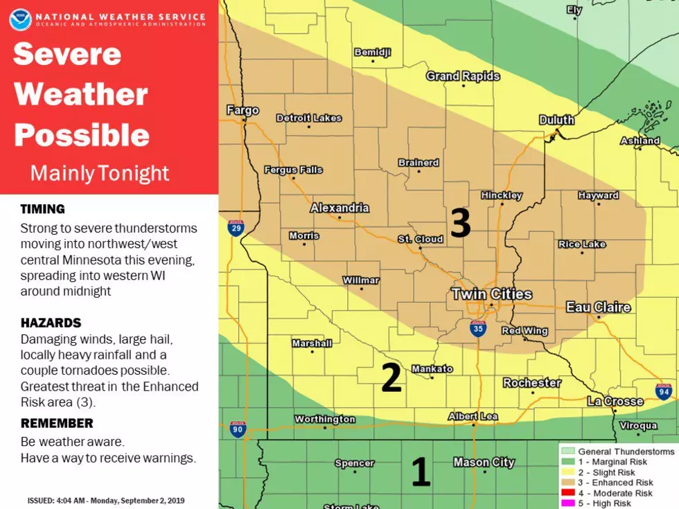
Yesterday we let you know about the potential for severe weather in Minnesota for tonight. The National Weather Service in the Twin Cities has upgraded the likelihood of severe weather for tonight, and where the increase in likelihood was predicted will affect a portion of Rice, Le Sueur, and Goodhue Counties and all of Dakota and Scott County.
Steele, Olmsted, Dodge, Waseca, and Wabasha Counties will also be under the threat of severe weather tonight, although the likelihood of severe weather is less than the orange area indicated in the Tweet sent out this morning by the National Weather Service in the Twin Cities.
It's a good idea to stay weather aware as we head into the evening hours tonight. Additionally, the National Weather Service advises you to be in an area where you can receive severe weather notifications.
In a hazardous weather outlook for tonight, it states that: "There is an Enhanced Risk of severe thunderstorms tonight north of a line from Appleton to Faribault, Minnesota and Eau Claire, Wisconsin, with a Slight Risk elsewhere. Damaging winds, large hail, and a few tornadoes are possible with a line of severe thunderstorms this evening and overnight."
More From KRFO-AM