
Did You See Those Weird Clouds Over Duluth Yesterday?
On Wednesday afternoon, a coworker of mine asked "hey, there are some weird clouds over Park Point right now!" Thankfully I happened to be in a location where I could quickly get a view of the sky over Duluth's Park Point and there they were - the clouds she was referring to.
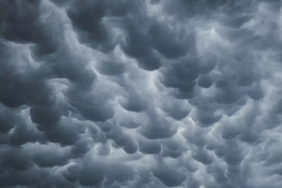
Those clouds, appearing dark, "bubbly", and somewhat ominous, were Mammatus clouds making their way through the Duluth area as some rain moved through on Wednesday afternoon.
Someone captured a photo of these clouds and shared it with meteorologist Justin Liles at our news partner WDIO.
The clouds, which aren't necessarily unheard of in the Northland, are pretty rare this time of year, as Liles pointed out in his Facebook post showing off the photo of these clouds.
What causes Mammatus clouds?
These pouch-like clouds are often thought of by people as clouds associated with severe weather. As learnweather.com explains, that isn't always the case, however.

The cause of this unique type of cloud formation is downdrafts, or sinking air, pushing parts of the cloud base down into these unique shapes. While they can often be seen as part of severe thunderstorms, they can also develop with less severe rain and storm events (as happened this week).
Many people often associate these clouds with incoming severe weather, but they are most often seen after the strongest part of a storm passes through, developing from sinking air on the backside of a stormcloud.
While there was no severe weather associated with this week's Mammatus clouds, seeing them was a good reminder that we are heading into thunderstorm season.